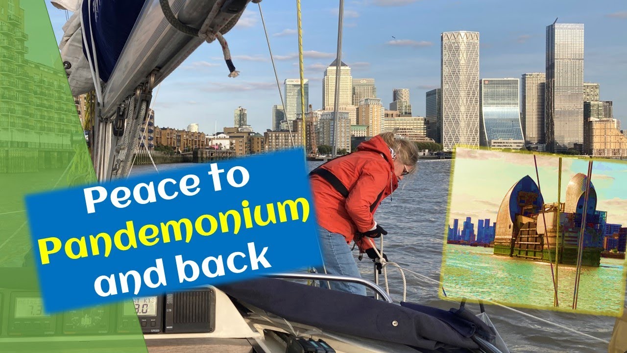
Long Way Down Episodul 4: Urcând cu barca pe râul Tamisa evitând taxiurile rapide pe apă, croazierele fluviale, căutătorii de senzații tari și navele de marfă. De la Wells-next-the-Sea la Lowestoft, Harwich, Gillingham, Londra, Queenborough, Ramsgate și Eastbourne. Opțiunile ne duc în jos, în jurul coastei de est a Angliei și în sus râuri peste 320 de mile marine, cu un ocol inutil către Londra pentru a vedea Podul Queen Elizabeth, Thames Barrier, Millennium Dome și multe altele în drumul nostru către East End și London Docklands, care la un moment dat a fost unul dintre cele mai mari porturi din lume. De ce să facem un ocol de 100 de mile marine când scopul nostru este Drumul Lung spre Medie? Aveam două săptămâni rămase de la contractul nostru de 12 luni cu Hull Marina, care (la acea vreme) permitea clienților să acosteze în porturile asociate fără a plăti suplimentar. Limehouse Marina și Hull Marina sunt ambele deținute și administrate de Aquavista. Londra a fost casa mea de lucru de câțiva ani și încă deține un interes nostalgic. Ce modalitate mai bună decât să vezi priveliștile râului din propria ta barcă? Apoi este timp pentru un alt ocol. Ramsgate este portul din care am ales să părăsim Regatul Unit – dar nu vom face asta până nu vom naviga pe coasta de sud până la Insula Wight. Aflați de ce în Episodul 5. 00:00 – Început 01:08 – Ziua #4 până la Lowestoft 01:28 – Canal îngust Scroby 02:26 – Dezastru telefonic 02:44 – Ziua #5 până la Harwich 03:43 – Ziua #6 la Gillingham 05:10 – Ziua #7 la Londra 06:25 – London Millennium Dome plus 07:34 – London Limehouse 08:20 – Ziua #10 la Queenborough 08:38 – Ziua #11 La Ramsgate 10:23 – Ziua #12 la Eastbourne 11:43 – Sosire la Eastbourne 12:08 – Data viitoare. . . Mulțumiri și link-uri: Lowestoft Yacht Basin: https://www.rnsyc.net/wordpress/the-marina/ Harwich Harbour: https://hha.co.uk/ Ha’penny Pier: https://www.harwich- society.co.uk/maritime-heritage-trail/ Gillingham Marina: http://www.gillingham-marina.co.uk/ Thames Barrier: https://www.gov.uk/guidance/the-thames-barrier Thames Rachete: https://www.thamesrockets.com/ Cutty Sark: https://www.rmg.co.uk/cutty-sark Millennium Dome: https://rshp.com/projects/culture-and-leisure/the -millennium-dome/ Limehouse Marina: https://www.aquavista.com/find-a-marina/limehouse-waterside-marina Cruising Association: https://www.theca.org.uk/public/about London Docklands History : https://www.museumoflondon.org.uk/museum-london-docklands Queenborough Harbour: https://queenborough-harbour.co.uk/ Ramsgate Harbour: https://ramsgateroyalharbour.co.uk/ Sovereign Harbour: https ://www.premiermarinas.com/UK-Marina-locations/Sovereign-Harbour-Marina-Eastbourne Muzica prezentată în acest videoclip nu are drepturi de autor: Tropi c Fuse – French Fuse Sea Space – Emily A. Sprague Large Smile Mood – Nico Staf Out on my Skateboard – Mini Vandals Put It – Track Tribe Island Dream – Chris Haugen Rain Fuse – French Fuse Here it Comes – Track Tribe
source
Navigați pe râul Tamisa până la London East End. De ce să faceți un ocol de 100 de mile?
3 thoughts on “Navigați pe râul Tamisa până la London East End. De ce să faceți un ocol de 100 de mile?”
Comments are closed.

Loving the journey – keep em coming
Great fun! Sorry about the loss of the phone! Perhaps locating one of those see-through plastic covers that will permit full function of the phone while encased, might be helpful. With the air inside, it floats. A lanyard goes around the wearer's neck and can be worn inside foul weather gear with no effort. Ask me how I know… LOL! Looking forward to the next installment. 60 miles is a well-earned beer. Be well, be safe!
Great video